Ex-Tropical Cyclone Seth Drives Damaging Surf Conditions
Wild weather keeps beaches closed
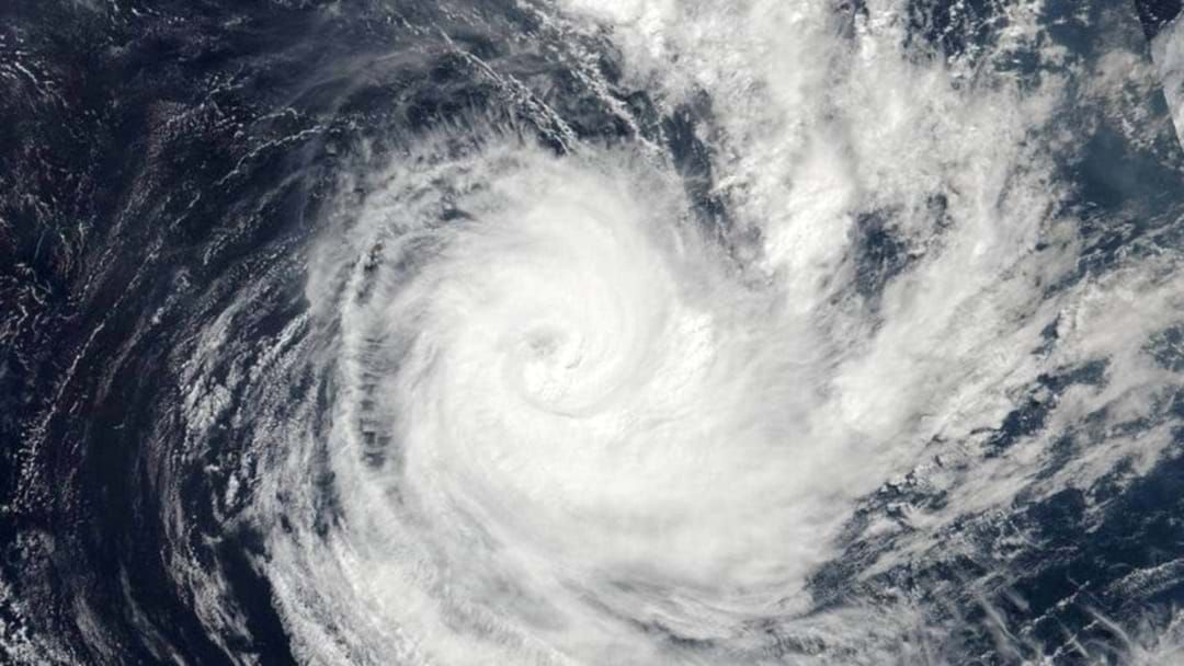
NASA/NOAA
The Bureau of Meteorology (BOM) have warned that Ex-tropical Cyclone Seth had reached the southern Coral Sea “generating seas and swells that are impacting exposed areas of the southeast coast” and is making its way down the coast.
The cyclone was downgraded on Sunday from a category 1 to a category 2, and then again down to a sub-tropical low after forming off the Mackay coast on New Year’s Eve, before heading south.
Stay up-to-date on the latest news with The National Briefing - keeping you in the loop with news as it hits.
Expected early in the week to hit Queensland's coast, BOM has issued a warning that surf and swell conditions were “expected to be hazardous for coastal activities such as a rock fishing, boating and swimming”.
With reports of damaging wind gusts, high tides, and dangerous surf, forecasters expect hazardous surf conditions for the Byron and Coffs coasts in NSW, extending right up to the Fraser Coast in Queensland, with swells reaching up to three metres.
On Sunday, Deputy Police Commissioner Shane Chelepy urged Queenslanders to avoid flood waters and be prepared for wild and dubious weather.
"Cyclones are unpredictable and we are monitoring this one very closely," DC Chelepy said.
“What we are expecting to see is very high tides on the coast in our low-lying areas, potentially some flooding as a result of those high tides, and some severe weather action on the coast with respect to waves and damaging surf."
"As always, our disaster management systems stand ready to support Queensland if that cyclone should take an unexpected turn," he said.
Meanwhile, Brenden Scoffell from Surf Lifesaving Queensland has warned holiday makers and surf enthusiasts to pay attention to beach closures and not take any unnecessary risks over long weekend.

"Lifesavers have closed the beach for a reason because it's very difficult to see the amount of water moving around, because of the amount of white water coming in with the large swells," he said.
"The rips are very strong at the moment and we're seeing a lot of surges come through with the high tides as well.
"You might think you're in knee-deep water, and the next minute the next wave comes in and you're in up over your head and you're in trouble," he warned.
Surf Life Saving Queensland has advised:
- People should consider staying out of the water and avoid walking near surf-exposed areas.
- Rock fishers should avoid coastal rock platforms exposed to the ocean and seek a safe location that is sheltered from the surf.
- Boaties planning to cross shallow water and ocean bars should consider changing or delaying their voyage.
- Boaties already on the water should carry the appropriate safety equipment and wear a lifejacket.
- Boaties should remember to log on with their local radio base and consider their safety management plan.
All beaches on the Gold Coast remain closed on Monday, as the tropical cyclone and king tides continue to cause hazardous conditions.
For Australians looking for intelligent and unbiased news coverage, join renowned journalist Natarsha Belling on Your Morning Agenda for breaking national and international stories as well as the top business and finance stories - every weekday from 6:30am on Listnr
3 January 2022
Article by:
Triple M Newsroom